

Topografisk karta Waverley
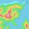
Klicka på kartan för att visa höjden.
Waverley
Waverley Council takes its name from the suburb but its administrative centre is located in the adjacent suburb of Bondi Junction, which is also a major commercial centre. Waverley is the highest point of altitude in Sydney's Eastern Suburbs.
Om denna karta

Namn: Topografisk karta Waverley, höjd, relief.
Medelhöjd: 60 m
Minsta höjd: 0 m
Maxhöjd: 113 m
Andra topografiska kartor
Klicka på en karta för att se dess topografi, dess höjd och dess relief.


St Leonards Park
Australia > New South Wales > Sydney > North Sydney
In 2018 it was announced that North Sydney Council would commence an upgrade of the park including improving the war memorial with a reflection pool, restoration of the Tunks Fountain and elevation on a new plinth, new benches, picnic tables, barbecues and drinking fountains, upgrades to lighting, additional…
Medelhöjd: 61 m






Bents Basin State Conservation Area
Australia > New South Wales > Sydney
The park is popular for swimming, kayaking, bushwalking, camping (with 100 tent sites), barbecuing, picnicking and fishing. The park also features walking trails within a bushland and an education centre with a commercial kitchen. Caley's Lookout Track, a walking track within the bushland, leads to Little…
Medelhöjd: 82 m


