

Topografisk karta St Georges Basin
Klicka på kartan för att visa höjden.
Om denna karta

Namn: Topografisk karta St Georges Basin, höjd, relief.
Medelhöjd: 18 m
Minsta höjd: -3 m
Maxhöjd: 132 m
Andra topografiska kartor
Klicka på en karta för att se dess topografi, dess höjd och dess relief.

Sydney
Phillip had been given no instructions for urban development, but in July 1788 submitted a plan for the new town at Sydney Cove. It included a wide central avenue, a permanent Government House, law courts, hospital and other public buildings, but no provision for warehouses, shops, or other commercial…
Medelhöjd: 32 m

Australian Alps
The Australian Alps are a mountain range in southeast Australia. It comprises an interim Australian bioregion, and is the highest mountain range in Australia. The range straddles the borders of eastern Victoria, southeastern New South Wales, and the Australian Capital Territory. It contains Australia's only…
Medelhöjd: 2 037 m

Blue Mountains
A sandstone plateau dominated by a landscape of endless eucalyptus forests, the Blue Mountains are located at the top of a 470-million-year-old quartzite. In the Permian period, a shallow sea covered the region, when rivers brought shales, siltstones and mudstones. Then during the Mesozoic period, rivers…
Medelhöjd: 566 m


Mount Twynam
With an elevation of 2,195 metres (7,201 ft) above sea level, Mount Twynam is the 3rd-highest mountain on mainland Australia. It is located 8 kilometres (5.0 mi) north-east of Mount Kosciuszko.
Medelhöjd: 1 992 m


Mount Banks
Mount Banks, otherwise known as Mount King George, is a mountain within the Explorers Range of the Blue Mountains Range that is a spur off the Great Dividing Range, is located within the Blue Mountains National Park, approximately 100 kilometres (62 mi) west of Sydney in New South Wales, Australia. Mount Banks…
Medelhöjd: 745 m
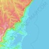


Pigeon House Mountain
Pigeon House Mountain (Aboriginal: Didthul) is a mountain at an elevation of 720 metres (2,360 ft) AHD on the Budawang Range that is situated within the Morton National Park, located on the South Coast region of New South Wales, Australia.
Medelhöjd: 378 m


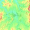


Budawang Range
The highest mountain in the range is Mount Budawang, which has an elevation of 1,129 metres (3,704 ft) above sea level.
Medelhöjd: 484 m


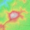

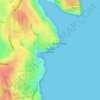


Mount Kościuszko
Mount Kosciuszko is the highest summit in mainland Australia. Until 1977 it was possible to drive from Charlotte Pass to within a few metres of the summit, but in 1977 the road was closed to public motor vehicle access due to environmental concerns. The road is open from Charlotte Pass for walkers and cyclists…
Medelhöjd: 2 035 m


Gaanha-bula–Mount Canobolas
With an elevation of 1,390 metres (4,560 ft) above sea level, Mount Canobolas, an extinct volcano, is the highest mountain in the region. Situated 13 kilometres (8.1 mi) southwest of the city of Orange, it is about 250 kilometres (155 mi) west of Sydney.
Medelhöjd: 1 186 m


