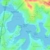
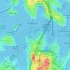
Topografisk karta Sutherland Shire Council
Klicka på kartan för att visa höjden.
Om denna karta

Namn: Topografisk karta Sutherland Shire Council, höjd, relief.
Medelhöjd: 79 m
Minsta höjd: -7 m
Maxhöjd: 367 m
Andra topografiska kartor
Klicka på en karta för att se dess topografi, dess höjd och dess relief.

Bents Basin State Conservation Area
Australia > New South Wales > Sydney
The park is popular for swimming, kayaking, bushwalking, camping (with 100 tent sites), barbecuing, picnicking and fishing. The park also features walking trails within a bushland and an education centre with a commercial kitchen. Caley's Lookout Track, a walking track within the bushland, leads to Little…
Medelhöjd: 82 m




Nielsen Park
Australia > New South Wales > Sydney
As is common in all coastal and estuarine areas of the Sydney Region, the Park contains many rock outcrops, particularly along the foreshore headlands. These are given some added interest by the remnants of the effect of a basalt dyke that runs from Mount Trefle to Bottle and Glass Point resulting in the…
Medelhöjd: 14 m